A U T H O R S P R E F A C E
It was the incessant and irreversible alteration taking place at the Castle of Naxos (a living monument whole of the Venetian domination period), along with the lack of respective research, and the author’s being in the employ of the Ministry of Culture working on relevant topics, that prompted him to choose the subject of this study. The above mentioned Castle presented the advantage that several authentic pieces of evidence had survived up to the end of the 1980s, namely is up to the impact of the tourism on Cyclades.
Determinative factor for undertaking this research in 1986 (a doctoral thesis) was the acquaintance with the dear departed professor Gottfried Gruben, during the author’s graduate studies (Technical University of Munich, Department of Monument Conservation and Building Archaeology), who had supervised the research up to 2001. Then, professor Manolis Korres (National Technical University of Athens) * , to whom thanks for his contribution are expressed, undertook the supervision.
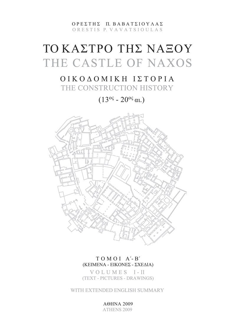
The extensive research deals with a compound and sizable subject referring to the History of Urban Planning and Architecture, focusing in the region nowadays occupied by the Castle, 20.000 or so m2 in area, including 54 properties.
The research mainly aimed to the investigation of the initial construction phase, the creation of the Castle. Only few pieces of evidence referring to this period survive. The evolution of the Castle to a fortified city, a castle-city, also suffers from such lack of evidence. The method implemented for the safe documentation of this monument whole and its temporal evolution, especially, though, of its first settlement phase, mainly relied upon the deliberate investigation of the majority of the nowadays accessible buildings and other significant constructions. Given that this medieval Castle was never abandoned − on the contrary, it has remained an evolving alive settlement to date, with the relevant to this fact impacts to its construction –, the collection and the co-examination of history, record, and material evidence were judged necessary for all the subsequent phases, beginning from the contemporary period and spreading towards past, widening in this way the research scope. Thus, this study grew to be a broader work, contribution to the study of the medieval city in Greece, and possibly a useful reference for future researchers.
It must be noted that the lack of appropriate and accurate enough topographical maps led to the development of a new map, by the use a complete geodetic network, according to the E.G.S.A. 87 system. The surveying data were connected with the above mentioned network. The degree of significance, along with the difficulty in accessing some areas (inhabited private buildings), and the complexity of the subject, led to the use of various measurement methods and instruments (theodolite, measuring tape, orthogonal prism etc), resulting in differentiation in terms of precision. The drawings have been worked out by the use of non-computerized means until 1994. Since then, CAD, offering greater flexibility in terms of analysis and presentation, has been used. A total of ten floor plan levels were used, because of the steepness of the site. Each level was divided in six sectors. A codification system was used for the data referring to each place (property or place number, level number, altitude, degree of precision etc).
The study, because of its extent, is presented in two supplementary volumes. Volume I contains the text, whereas Volume II contains original drawings in 91 tables.
Volume I (the text) is divided in seven chapters, and contains also an extended English Summary (see Contents) with references to pictures and drawings in Volume II.
O r e s t i s P. V a v a t s i o u l a s
Athens 2009
* The doctoral thesis applied in 2006 and approved in July 2007 by the N.T.U.A. (National Technical University of Athens).